top of page
Handheld surveying controller equipment in protective orange carrying case

Renewable energy surveys in Doncaster for solar and wind projects

Detailed site information. Accurate topographical data. Surveys for solar and wind projects.

Better site information for renewable projects

Solar farm surveys

Detailed site information helps inform the planning and design of solar farm developments.

Wind farm surveys

Accurate survey information supports the planning and development of wind energy sites.

Renewable site surveys

Topographical and site surveys can be tailored to the land, project scope and information requirements.

Solar farm surveys

Solar farm surveys provide measured information about potential or existing solar development sites. Topographical and site data can help establish ground levels, terrain, access routes and other physical features relevant to solar farm planning and design.

Digital surveying controller interface displaying field survey data
Prism reflector target mounted on surveying pole in open land

Wind farm surveys

Wind farm surveys provide accurate spatial information about proposed or existing wind energy sites. Survey data can support site assessment, access planning, infrastructure design and the positioning of associated project elements.

Topographical surveys for renewable energy

Topographical surveys for renewable energy projects capture ground levels and relevant physical features across a proposed development area. The information can provide a reliable base for design, engineering and construction planning.

Total station instrument set up overlooking field terrain
Handheld field data collector device on site surface

Site surveys for solar farms

Site surveys for solar farms establish detailed information about the land and existing site conditions. Surveys can identify levels, access, boundaries and physical features that may need to be considered during the design and development process.

Site surveys for wind farms

Site surveys for wind farms provide measured information about the proposed development area and its surroundings. Survey data can assist with access design, infrastructure planning, construction preparation and the coordination of site works. For renewable energy developments, we also offer topographical & land surveys and highways & infrastructure surveys to support site assessment and project planning.

Surveyor in high-visibility jacket operating tripod equipment

Frequently asked questions

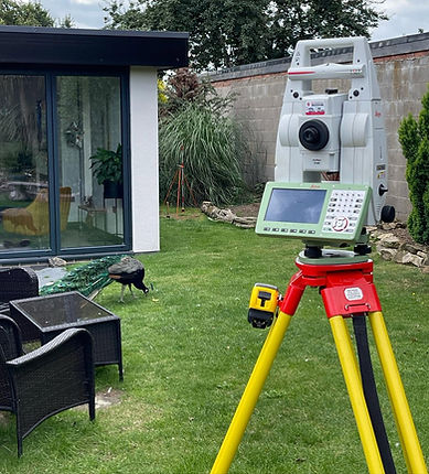
Leica total station surveying unit positioned on grassy ground

Discuss your renewable energy survey

Tell us about your solar, wind or renewable energy project and the site information you need so we can discuss the appropriate survey scope.

Contact us

GEOSurveys Limited

Hayfield lakes, Hayfield Ln, Auckley, Doncaster DN9 3NP, UK

Business hours

Monday - Friday : 08:00 - 17:00
Saturday - Sunday : Closed

Review us on Yell.com
  • X
  • Facebook
  • LinkedIn
  • Instagram
  • Google Business Profile

GEOSURVEYS LTD, registered as a limited company in England and Wales under company number: 04813567.
Registered Company Address: Hayfield Cottage Hayfield Lane, Auckley, Doncaster, England, DN9 3NP.

Terms of Use | Privacy & Cookie Policy | Trading Terms

© 2026. The content on this website is owned by us and our licensors. Do not copy any content (including images) without our consent.

bottom of page