top of page
Total station target instrument set up overlooking foundation trench work on building site

Construction setting out and site engineering in Doncaster 

Accurate information where construction happens

Accurate information where construction happens

Construction setting out

We establish the positions, dimensions and levels required to help construction teams build accurately from the approved design.

Foundation and piling setting out

Accurate setting out supports foundation and piling works by establishing the required locations and positions on site.

Site engineering support

Practical surveying and engineering support can be provided throughout different stages of a construction project.

Construction setting out

Construction setting out transfers positions and dimensions from the design information to the physical site. Survey control can be used to establish building lines, grid positions, coordinates and levels required for construction activities.

Digital controller device laying next to ground setting out pin markers on concrete
Survey pin and marking flag inserted into ground at construction site

Foundation setting out

Foundation setting out identifies the precise positions and dimensions of foundations before excavation and construction. Accurate coordinates and levels help construction teams establish foundation locations in accordance with the relevant engineering drawings.

Piling setting out

Piling setting out establishes the required positions of piles on a construction site. Precise survey control can help identify pile centres and associated coordinates, providing the construction team with reliable information before piling operations commence.

Site engineer in high-visibility jacket inspecting excavated piling foundation pit
Surveying total station mounted on tripod beside site excavation works

Brickwork setting out

Brickwork setting out establishes the positions, dimensions and alignments required for masonry construction. Survey information helps ensure that walls, openings and other features are built according to the intended design.

Roadworks setting out

Roadworks setting out provides the positions and levels required for roads, kerbs, drainage and associated infrastructure. Survey control can support accurate construction of alignments, gradients and finished levels throughout a project. 


Alongside setting out, we provide highway & infrastructure surveys and topographical & land surveys to support accurate construction and infrastructure projects.
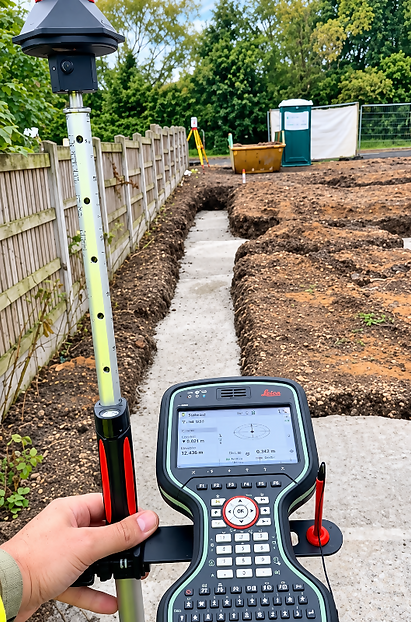
Hand holding handheld surveying controller attached to prism pole for road setting out
Surveying equipment setup positioned near concrete structural site foundations

Site engineering

Site engineering combines surveying expertise with practical construction support. Services can include establishing control, checking levels, interpreting design information and providing dimensional information to help construction teams coordinate works accurately.

Frequently asked questions

Leica surveying equipment set up outdoors on construction development site

Discuss your site setting out requirements

Send us your project details and drawings so we can understand the setting out and site engineering support required.

Contact us

GEOSurveys Limited

Hayfield lakes, Hayfield Ln, Auckley, Doncaster DN9 3NP, UK

Business hours

Monday - Friday : 08:00 - 17:00
Saturday - Sunday : Closed

Review us on Yell.com
  • X
  • Facebook
  • LinkedIn
  • Instagram
  • Google Business Profile

GEOSURVEYS LTD, registered as a limited company in England and Wales under company number: 04813567.
Registered Company Address: Hayfield Cottage Hayfield Lane, Auckley, Doncaster, England, DN9 3NP.

Terms of Use | Privacy & Cookie Policy | Trading Terms

© 2026. The content on this website is owned by us and our licensors. Do not copy any content (including images) without our consent.

bottom of page